JOHANNESBURG — Africa does not lack mineral potential. In many regions, it lacks sufficiently detailed, modern and accessible knowledge of what lies beneath the ground.
Geological maps created decades ago remain valuable, but many were produced at regional scales, stored on paper or built from widely spaced observations. Thick soil, desert sand, dense vegetation and younger sedimentary cover can also conceal the bedrock that conventional surface mapping depends upon. The result is a costly information gap: governments negotiate without a complete national picture, explorers repeat work that may already exist, and promising areas struggle to attract disciplined capital.
New geological surveying techniques in Africa can narrow that gap. Satellites can screen entire countries. Drones can map priority targets in centimetre-scale detail. Modern airborne systems can reveal structures beneath cover. Portable instruments can guide field teams in real time. Passive seismic and electromagnetic methods can investigate deeper architecture, while artificial intelligence can search for patterns across datasets too large for manual interpretation alone.
None of these technologies directly proves an economic mineral deposit. They generate evidence, targets and geological understanding. Discovery still requires field verification, sampling, drilling, laboratory analysis, resource modelling and competent professional judgement. The opportunity is to make every later stage better targeted, faster and less wasteful.
Geological information is national economic infrastructure
High-quality public geoscience can lower the earliest and riskiest stage of mineral exploration. It can also help governments plan infrastructure, identify groundwater systems, understand geohazards, monitor abandoned mines and evaluate the cumulative environmental pressure on important landscapes.
The African Union’s African Minerals Geoscience Initiative has argued for improved geological and mineral-information systems to support exploration and mining investment. The central lesson is as relevant today as when the initiative began: data quality, standardisation, accessibility and institutional capacity matter as much as the equipment used to collect the data.
Other countries provide a useful model. The United States Geological Survey’s Earth Mapping Resources Initiative combines geological mapping with geophysical, geochemical, topographic, hyperspectral and mine-waste data. Geoscience Australia has similarly integrated airborne electromagnetics, passive seismic, magnetotellurics, groundwater information and other datasets through its national geoscience programmes.
African countries do not need to copy either model exactly. They can build a staged approach suited to their geology, budget, land-access conditions and development priorities.
1. Satellite mapping: the fastest national starting point
Freely available Earth-observation data should be the first layer in almost every modern national mapping programme. Multispectral satellites record reflected energy in several wavelength bands, allowing geologists to distinguish broad rock units, map iron oxides and certain alteration minerals, identify lineaments and faults, and track changes in land disturbance.
Copernicus Sentinel-1 radar can collect information through cloud and darkness, while Sentinel-2 provides multispectral optical imagery. ASTER adds useful visible, near-infrared and thermal-infrared bands, and newer hyperspectral instruments such as NASA’s EMIT divide reflected light into many narrower wavelengths that can distinguish a wider range of surface minerals.
The European Space Agency has already supported the use of Sentinel data for geological and mineral mapping in Africa. NASA explains that EMIT measures mineral spectral signatures, while ASTER provides global multispectral coverage useful across many Earth-science applications.
This makes satellite work attractive to geological surveys with limited budgets: a national team can screen large territories before sending expensive aircraft or field crews. The limits must remain clear. Satellites primarily observe the surface. Vegetation, transported soil, weathering, cloud and mixed pixels can hide or distort geological signals. Every interpretation therefore needs field checking and should be treated as a targeting layer, not evidence of a mineral resource.
2. Drone photogrammetry and LiDAR: turn priority ground into 3D
Once satellite analysis identifies a prospective corridor, drones can close the resolution gap between regional imagery and boots-on-the-ground mapping.
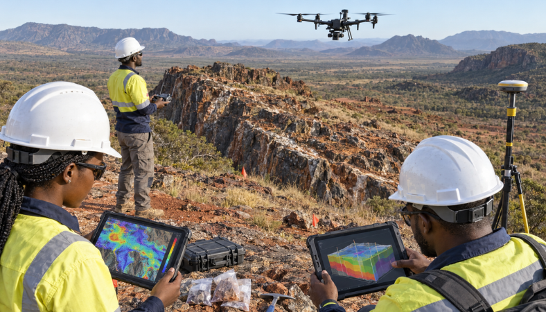
Standard cameras can collect overlapping photographs that photogrammetry software converts into orthomosaics, elevation models and three-dimensional outcrop surfaces. Geologists can map contacts, veins, faults, artisanal workings and access routes with far greater spatial consistency than handwritten sketches alone. Repeated flights can also measure changes in excavations, waste dumps, erosion and rehabilitation.
LiDAR-equipped aircraft or drones use laser pulses to build high-resolution elevation models. In suitable conditions, the point cloud can help separate vegetation from the ground surface and expose subtle landforms, fault scarps, drainage patterns and structural trends. The USGS topographic LiDAR programme reports that high-resolution elevation data can substantially improve the precision and efficiency of geological mapping.
Drone surveying is not simply a matter of purchasing an aircraft. Countries need flight regulations, trained pilots, survey-grade positioning, ground-control procedures, terrain-following plans, battery and maintenance systems, community notification, secure data handling and quality standards for the final products.
3. Drone-borne geophysics: high-resolution surveys without a full aircraft campaign
Lightweight magnetometers, radiometric sensors and selected electromagnetic instruments can now be carried by unmanned aerial vehicles. This allows closer line spacing and lower survey heights over targeted areas than many conventional regional aircraft programmes, potentially revealing smaller structural features and magnetic contrasts.
Drone magnetics can be particularly useful for mapping faults, dykes, lithological boundaries, buried infrastructure and magnetic minerals. It may also provide a safer option over steep, swampy or otherwise difficult ground where crews would struggle to maintain consistent survey lines.
Recent primary research has demonstrated integrated UAV aeromagnetic systems with automated flight paths, terrain following and high-sensitivity magnetometers. The work shows the technology’s growing capability, but also highlights the importance of controlling noise from the aircraft, motors, flight direction and sensor motion. See the 2026 study of an integrated unmanned aeromagnetic survey system.
For African geological surveys, the strongest use case is targeted infill: begin with regional satellite and airborne data, then use drones to examine priority anomalies before committing to trenching or drilling. Drones do not replace regional aircraft where very large areas must be covered consistently.
4. Modern airborne geophysics: see through soil, sand and vegetation
Country-scale airborne magnetic and radiometric surveys remain among the most important investments a government can make in precompetitive geoscience.
Magnetic surveys measure variations in the Earth’s magnetic field caused by contrasting rock properties. They can help identify concealed faults, intrusions, greenstone belts and lithological boundaries. Radiometric systems measure natural gamma radiation associated principally with potassium, uranium and thorium near the surface, providing another layer for geological interpretation.
Airborne electromagnetic surveys transmit an electromagnetic signal and measure the subsurface response. They can map variations in electrical conductivity associated with groundwater, clay, saline water, graphite, sulphide minerals and geological boundaries. Because several materials can produce similar responses, an electromagnetic anomaly is not automatically an orebody; it must be interpreted with geology, magnetics, geochemistry and follow-up work.
The USGS airborne geophysical programme uses magnetic and radiometric surveys to identify buried rock types and structures connected to minerals, energy, groundwater and geohazards. African experience is also growing. Sierra Leone completed nationwide airborne geophysical coverage through a World Bank-supported programme, while Zambia launched a nationwide high-resolution aerial geophysical survey in 2024 to support more targeted exploration, according to the World Bank’s recent analysis of Zambia’s copper sector.
The value of an airborne campaign depends on procurement discipline. Governments should retain the raw flight-line data, calibration records, processing history, metadata, grids and interpretation products—not only attractive final maps supplied by a contractor.
5. Portable geochemistry and digital field mapping: make every field day count
Portable X-ray fluorescence instruments can rapidly screen rocks, soils, stream sediments and drill material for many elements. Field spectrometers can identify alteration minerals from their spectral response, while portable laser-induced breakdown spectroscopy is emerging as another rapid elemental-screening tool.
Used correctly, these instruments help teams decide where to collect formal laboratory samples, extend traverses or investigate an anomaly. They are especially valuable when linked to digital field-mapping applications that capture coordinates, photographs, structures, lithology and sample identifiers directly into a controlled database.
Portable readings are not automatically equivalent to certified laboratory assays. Moisture, grain size, uneven surfaces, sample preparation, calibration and detection limits can affect results. A national programme needs reference materials, blanks, duplicates, instrument checks, documented workflows and laboratory confirmation. The instrument should guide decisions in the field; it should not be used to manufacture false precision.
6. Passive seismic and magnetotellurics: investigate the deeper geological architecture
Many future discoveries will be concealed beneath younger cover or located within geological systems that cannot be understood from the surface alone.
Passive seismic stations record natural earthquakes and background vibrations rather than relying entirely on artificial energy sources. By comparing signals across an array, geoscientists can construct models of variations in seismic velocity and infer major crustal boundaries, basin geometry and deep structures.
Ambient-noise tomography uses the continuous background vibration recorded between station pairs to extract information about the subsurface. Geoscience Australia’s AusArray programme demonstrates how a collaborative passive-seismic network can support continental geological interpretation. Its published work shows how ambient-noise methods can image first-order structures relevant to later resource assessments.
Magnetotelluric surveys measure naturally varying electric and magnetic fields to estimate subsurface electrical resistivity from shallow levels to deep crustal scales. Conductive pathways can be associated with fluids, graphite, sulphides, alteration or structural zones, but interpretations remain non-unique and must be integrated with other evidence.
These techniques are more specialised than routine surface mapping, yet countries can deploy them progressively across priority belts or through cross-border regional partnerships. The stations generally have a lighter surface footprint than dense drilling campaigns, although land access, security, maintenance and community consultation remain essential.
7. AI-assisted prospectivity mapping and three-dimensional geological models
Artificial intelligence becomes useful when a geological survey has organised data worth analysing.
Machine-learning systems can examine spatial relationships among mapped geology, structures, geochemistry, geophysics, satellite-derived alteration, known mineral occurrences and drilling results. They can rank areas by similarity to a defined mineral-system model and reveal combinations that a human team may not identify quickly.
The output is a prospectivity map—not a discovery and certainly not a mineral resource. Models can reproduce the biases, gaps and mistakes in their training data. If most historical exploration occurred close to roads, known mines or exposed rock, an algorithm may learn the geography of previous spending instead of the geology of undiscovered deposits.
African geological surveys should therefore require explainable inputs, uncertainty maps, independent validation and review by experienced geologists. Sensitive licence data must be separated from public precompetitive information, and algorithms trained on national datasets should be governed by clear rules on ownership, cybersecurity and permitted reuse.
Three-dimensional geological modelling provides the framework that connects these layers. As new drilling, geochronology or geophysics becomes available, the national model can be updated rather than redrawn from the beginning. Over time, this creates a living geological asset instead of a collection of disconnected reports.
An affordable adoption path for every country
Countries beginning with limited budgets
The first priority should be a national inventory of existing maps, reports, samples, geophysical tapes, laboratory records and historical drilling. Governments can digitise the most valuable records, adopt consistent coordinate and metadata standards, and begin nationwide interpretation using free Sentinel, ASTER and other public datasets.
Small drone teams, mobile GIS tools, field spectrometers and carefully controlled portable geochemistry can then improve selected high-potential districts. Training local geologists, data managers and technicians should be part of every equipment contract.
Countries ready for intermediate investment
The next stage is modern airborne magnetic and radiometric coverage over priority mineral belts, supported by systematic geochemical sampling, upgraded laboratories and drone-based infill surveys. A national geodata portal should publish usable digital files, metadata and licensing terms rather than map images alone.
Cross-border cooperation can lower costs where greenstone belts, sedimentary basins, mobile belts and mineral systems extend across political boundaries. Regional technical standards also make adjoining datasets easier to combine.
Countries pursuing advanced deep exploration
Countries with stronger institutions and high-priority covered terrain can add airborne electromagnetics, airborne hyperspectral surveys, passive-seismic arrays, magnetotellurics, digital core scanning, 3D geological models and AI-assisted prospectivity analysis.
Advanced technology should not consume the entire budget. Funds must remain available for field verification, laboratory work, community engagement, independent quality control and long-term data stewardship. A sophisticated survey that cannot be checked, maintained or reused locally is a short-term demonstration—not lasting national infrastructure.
Data sovereignty must be written into every contract
The most serious risk is not only choosing the wrong technology. It is paying for national data and losing practical control of it.
Survey contracts should state that the country receives the raw observations, corrected data, processing scripts or documented workflows, calibration files, coordinate-reference information, metadata, interpretation products and unrestricted archival copies. They should also define confidentiality periods, cybersecurity requirements, vendor access, cloud-storage locations, skills transfer and the government’s right to publish precompetitive layers.
Open foundational data can reduce duplicated exploration and improve investor confidence. Detailed company-funded exploration data may require lawful confidentiality for a defined period. The balance should be transparent and predictable rather than negotiated inconsistently after acquisition.
Better targeting can reduce unnecessary disturbance
Modern surveys can make exploration more selective. Satellite screening, airborne coverage and geophysical integration may reduce the number of poorly targeted roads, trenches and drill pads needed to test a large region. The same datasets can help identify rivers, wetlands, settlements, cultural sites and sensitive habitats before fieldwork begins.
That does not remove the need for environmental and social assessment, land-access agreements or free, prior and informed processes where Indigenous Peoples’ rights are engaged. Technology improves targeting; it does not replace consent, law or professional responsibility.
What an investment-ready geological package should contain
A credible government or project owner should be able to present:
Clear ownership, licence boundaries and permitting status.
Geological maps in usable digital formats with coordinate systems and metadata.
Raw and processed geophysical data with quality-control documentation.
Traceable sample locations, preparation methods and accredited laboratory results.
A geological interpretation that distinguishes observations from assumptions.
Target rankings with uncertainty, alternative explanations and proposed follow-up work.
Environmental, community, infrastructure and access constraints.
A staged exploration budget tied to decision points rather than an open-ended drilling request.
This is how new geological surveying techniques in Africa can translate into stronger transactions. Technology creates value only when its evidence can survive technical due diligence.
From national geodata to controlled mineral opportunities
African governments, geological surveys, exploration companies, investors and specialist contractors can use the AFRINOMICS Deal Room to pursue controlled exploration mandates, asset transactions and technical partnerships supported by verifiable data.
The strongest opportunity is not the concession with the boldest promise. It is the one where authority, geological evidence, data quality, risks, funding requirements and the next technical decision are clearly documented.
Africa’s next major discoveries may begin with a satellite pixel, a magnetic anomaly or a quiet seismic station—but they will be unlocked by African institutions that can own, interpret and convert that evidence into responsible development.
Editorial note: This article provides general industry information and does not constitute geological, legal or investment advice. Survey design, licensing, aviation approval, data governance, environmental assessment and technical interpretation must be completed by appropriately qualified professionals under the laws of the relevant jurisdiction.
Authoritative references and further reading
African Union: African Minerals Geoscience Initiative Technical Report
USGS: Earth Mapping Resources Initiative
European Space Agency: Sentinels Helping to Map Minerals
NASA Earthdata: EMIT Imaging Spectrometer Resources
Geoscience Australia: Exploring for the Future Data and Products
World Bank: Mineral Resources of Africa